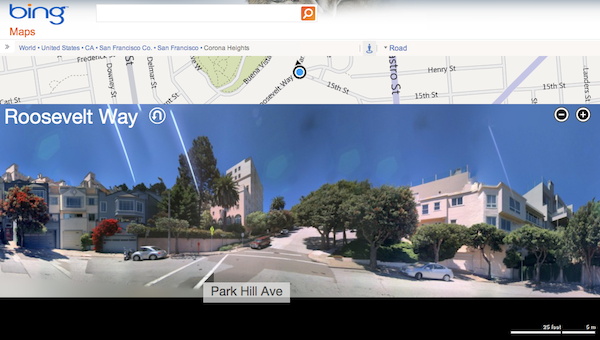
Bing Maps announced changes to it’s Streetside view. Using a novel interface, Bing has flattened steet-level images and lets you scroll the images as one gigantic panorama to navigate the map. Previously, Bing Maps had 360-degree panoramas in Streetside View. Referring to them as “bubbles,” Microsoft acknowledges the difficulty in navigating from “bubble to bubble,” especially across large areas.
Bing’s new Streetside View shows panoramas of the currently displayed street in beneath a snippet of the map along which you’re traveling. Information, including businesses, transportation and a scale of distance appear below the imagery. As you pan the image, the map and information areas update. An icon on the map indicates not only your position, but also the direction you are facing.
Using the scroll wheel or the buttons provided allows you zoom in and out of the image. A nifty U-Turn icon next to the street label allows you to switch the view to the opposite side of the street.

The image stitching is impressive and works surprisingly well, even on images of the hilly streets of San Francisco. While the experience is great in a browser, it is bound to be more impressive when it hits the Bing app for iPad.
